Exploring a cave without the right knowledge can turn an unforgettable adventure into a dangerous situation fast. If you’re searching for clear, reliable guidance on cave trekking basics, survival skills, navigation, terrain analysis, and outdoor gear tips, you’re in the right place. This article is designed to give you practical, field-tested insights that help you move confidently and safely underground.
We’ve studied real expedition reports, reviewed guidance from experienced spelunkers, and analyzed proven backcountry survival strategies to ensure the information here is accurate and actionable. Whether you’re learning cave map reading, preparing for your first trek, or refining advanced navigation techniques, you’ll find straightforward advice that prioritizes safety and smart decision-making.
By the end, you’ll understand how to assess terrain, choose essential gear, and apply core survival principles so you can explore with preparation—not guesswork.
Why Your Compass is Useless Underground
A compass works by aligning with Earth’s magnetic field In caves, that field is often distorted by iron-rich rock, meaning your needle can drift or spin GPS fails because it needs satellite signals, and solid rock blocks them This creates a three-dimensional maze where up, down, and sideways blur
To stay oriented, focus on
- Mental mapping (building a running picture of passages)
- Landmarks like airflow, water flow, and wall texture
- Deliberate cave map reading before and during travel
Think of it like Hogwarts’ staircases—except mistakes aren’t magical Clarity beats gadgets underground
The Core Skill: Mental Mapping and Dead Reckoning
First things first, dead reckoning is the practice of calculating your current position by estimating the direction and distance you’ve traveled from a known starting point. Sailors used it long before GPS (and long before anyone could blame “bad signal”). In a cave, it means knowing that you walked roughly 120 meters north-northeast from the entrance, then descended a sloping passage for another 40.
Now, distance underground isn’t measured with guesswork—it’s often measured with pace counting, which is exactly what it sounds like: counting your steps to estimate distance. To calibrate your pace, measure a 50-meter stretch on flat ground and count every double step. Then repeat it on slopes, in mud, and through shallow water. Your number will change (it always does). Pro tip: keep separate pace counts for flat and inclined terrain; fatigue can skew results by up to 5–10% (National Speleological Society).
As you move, you’re building a mental map—an internal, continuously updated model of the cave’s layout. This isn’t just cave map reading; it’s active observation. Notice junctions, distinctive speleothems (mineral formations like stalactites and stalagmites), ceiling height changes, airflow shifts, even echoes. I’m convinced the best cavers treat passages like scenes in a movie—you remember the set design, not just the plot.
Most importantly, use the “look back” method. Turn around frequently. The return view is never identical (seriously, it’s like the Upside Down in Stranger Things). In my opinion, this habit is what separates confident navigators from people who rely too heavily on luck.
Follow the Air
The first time I realized a cave “breathes,” I was wedged in a narrow passage, helmet light flickering against limestone. Then I felt it—a faint, cool draft brushing my cheek. That subtle airflow wasn’t random. In cave navigation, moving air often signals a larger chamber, a secondary entrance, or a connection deeper within the system. Warm air rising and cool air sinking create pressure differences, especially in multi-entrance caves (a bit like nature’s own ventilation system). If you pause and turn your face slowly, you can often pinpoint direction by temperature change alone.
Water as a Guide
Next, watch the water. Even when streams disappear, they leave clues. Scallops—small, spoon-shaped depressions in rock—form from flowing water and point downstream (U.S. Geological Survey). Likewise, sediment deposits pile up on the downstream side of rocks. I once backtracked successfully just by noticing scallops reversing direction after a junction. In other words, water writes arrows on the walls—if you know how to read them.
Geological Clues
Meanwhile, study the rock layers. “Dip” refers to the angle at which rock layers slope downward, while “strike” is their compass direction. If bedding planes consistently tilt one way, that slope becomes a natural compass. Over time, I’ve learned to treat consistent angles like trail markers.
Analyzing the Floor
Finally, analyze the floor texture. Breakdown (fallen rock) often marks unstable ceiling zones, while smooth bedrock suggests active water flow. Sudden shifts from mud to sand can signal junctions. Although cave map reading is useful, your boots often tell the story first.
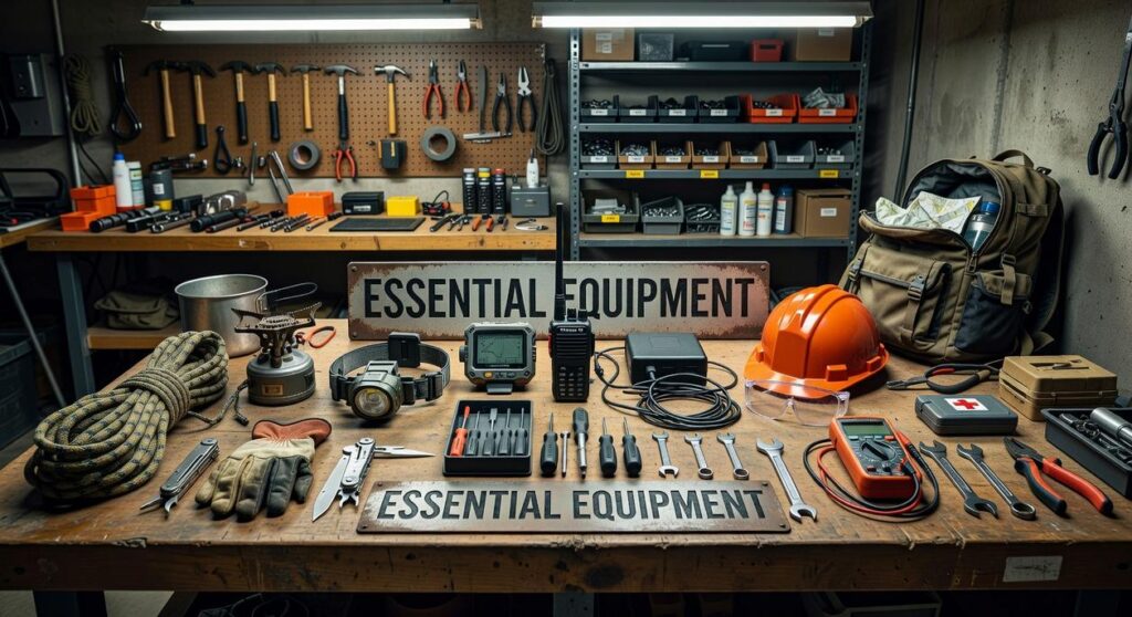
Essential Gear That Supports Your Skills

First, follow the Rule of Three for light. Carry three independent sources: a primary headlamp, a backup headlamp, and a handheld flashlight. If one fails (and underground, something eventually will), you’re not negotiating with darkness. Redundancy means each unit has fresh batteries and is stored separately. Pro tip: standardize battery types to avoid confusion in tight squeezes.
Next, mark your path responsibly. Use non-permanent flagging tape or small reflective markers only where navigation is genuinely complex. Then remove every marker on your way out. Leave No Trace isn’t optional; it preserves routes for others and protects fragile formations.
When it comes to mapping, invest in specialized tools. A Suunto compass and clinometer allow precise, short-distance measurements between survey stations. Unlike a basic hiking compass, these instruments account for local magnetic interference by focusing on controlled readings. Pair this practice with terrain analysis techniques for complex cave systems to sharpen decision-making.
Finally, study the cave map before entering. Learn common symbols for pits, flowstone, water, and survey stations. Cave map reading builds mental models so you recognize passage trends underground. Gear supports skill—but preparation makes it powerful. Choose quality equipment and practice deliberately every trip.
Pre-Expedition Drills and In-Cave Protocols
Before stepping underground, it helps to clarify a few core systems that prevent small mistakes from becoming big problems. First, the right-hand rule (or left-hand rule) is a simple navigation method: choose one wall—right or left—and follow it consistently through a complex passage. In other words, every time you reach a junction, you take the passage on that chosen side. This systematic exploration method reduces guesswork and makes backtracking far more reliable.
Next comes the “Wait and Mark” protocol. At every junction, the team pauses. A clear decision is made. Then the location is marked—mentally, on a map, or with temporary indicators—before moving forward. This prevents the classic “I thought we came from there” moment (which never ends well).
Equally important, communication must be deliberate:
- The team leader states the chosen direction aloud.
- Landmarks are described clearly.
- Every member confirms understanding.
Meanwhile, cave map reading should never be rushed; symbols, scale, and passage angles must be reviewed together.
Finally, lost-proofing starts before entry. Leave a detailed trip plan with a trusted contact, including your route and a firm call-out time. If you miss that deadline, they alert rescue services—no hesitation. Pro tip: build in extra buffer time for unexpected delays.
Confidence underground isn’t bravado; it’s preparation earned the hard way. I once trusted a glowing blue dot more than my senses, and when the signal bounced off limestone walls, I lost precious minutes second-guessing myself. That mistake taught me this: disorientation is usually preventable.
Instead, build a mental map as you move. Notice airflow, moisture, subtle slope changes. Practice cave map reading before you need it, and treat your compass and GPS as backups, not crutches. So where should you begin? Start small—revisit a familiar trail or simple cavern, rehearse your observations, and sharpen habits in low-risk terrain. Build steadily.
Take Your Next Step Underground with Confidence
You came here to better understand Horizon headlines, cave trekking basics, survival skills, navigation, terrain analysis, and outdoor gear tips—and now you have a clearer path forward. You know how preparation, awareness, and cave map reading work together to keep you oriented and safe when conditions get unpredictable.
The truth is, most underground emergencies don’t happen because of bad luck. They happen because of poor planning, weak navigation skills, or the wrong gear at the wrong time. When visibility drops and terrain shifts, uncertainty becomes your biggest threat.
Now it’s time to act. Review your navigation approach. Practice cave map reading before your next trek. Upgrade the gear that could fail you when it matters most.
If you’re serious about exploring smarter and safer, dive deeper into our expert-backed guides trusted by dedicated cavers worldwide. Get the skills, sharpen your instincts, and prepare properly—so your next expedition is defined by discovery, not danger.
 Trevana Dornhaven writes the kind of outdoor gear maintenance tips content that people actually send to each other. Not because it's flashy or controversial, but because it's the sort of thing where you read it and immediately think of three people who need to see it. Trevana has a talent for identifying the questions that a lot of people have but haven't quite figured out how to articulate yet — and then answering them properly.
They covers a lot of ground: Outdoor Gear Maintenance Tips, Cave Trekking Basics and Survival Skills, Horizon Headlines, and plenty of adjacent territory that doesn't always get treated with the same seriousness. The consistency across all of it is a certain kind of respect for the reader. Trevana doesn't assume people are stupid, and they doesn't assume they know everything either. They writes for someone who is genuinely trying to figure something out — because that's usually who's actually reading. That assumption shapes everything from how they structures an explanation to how much background they includes before getting to the point.
Beyond the practical stuff, there's something in Trevana's writing that reflects a real investment in the subject — not performed enthusiasm, but the kind of sustained interest that produces insight over time. They has been paying attention to outdoor gear maintenance tips long enough that they notices things a more casual observer would miss. That depth shows up in the work in ways that are hard to fake.
Trevana Dornhaven writes the kind of outdoor gear maintenance tips content that people actually send to each other. Not because it's flashy or controversial, but because it's the sort of thing where you read it and immediately think of three people who need to see it. Trevana has a talent for identifying the questions that a lot of people have but haven't quite figured out how to articulate yet — and then answering them properly.
They covers a lot of ground: Outdoor Gear Maintenance Tips, Cave Trekking Basics and Survival Skills, Horizon Headlines, and plenty of adjacent territory that doesn't always get treated with the same seriousness. The consistency across all of it is a certain kind of respect for the reader. Trevana doesn't assume people are stupid, and they doesn't assume they know everything either. They writes for someone who is genuinely trying to figure something out — because that's usually who's actually reading. That assumption shapes everything from how they structures an explanation to how much background they includes before getting to the point.
Beyond the practical stuff, there's something in Trevana's writing that reflects a real investment in the subject — not performed enthusiasm, but the kind of sustained interest that produces insight over time. They has been paying attention to outdoor gear maintenance tips long enough that they notices things a more casual observer would miss. That depth shows up in the work in ways that are hard to fake.