Most people step into a cave and see little more than rock, shadow, and scattered formations. But beneath that apparent chaos lies a detailed geological record waiting to be read. This practical guide goes beyond naming stalactites and stalagmites—it teaches you how to interpret the forces that shaped them. Through clear explanations grounded in field-based speleological observation and established geology, you’ll learn how water flow, mineral composition, and structural patterns reveal a cave’s history. By applying structured cave terrain analysis, you’ll begin to understand not just what you’re seeing, but the environmental story the cave is telling.
The Foundation of Darkness: How Water Carves the Earth
Caves begin with a simple chemical trick: rainwater absorbs carbon dioxide from the air and soil, forming carbonic acid. When this mild acid seeps into limestone (a soluble rock that dissolves easily), it slowly eats away the stone. Over thousands to millions of years, fractures widen into passages. Think of it as nature’s quiet sculptor—less blockbuster, more patient artisan.
However, not all cave passages form the same way. First, the vadose zone lies above the water table; here, water drips and streams downward, carving tall, canyon-like corridors. In contrast, the phreatic zone sits below the water table, where tunnels form completely submerged, creating rounded, tubular shapes.
So, what should you look for next underground?
- Tall walls and floor trenches signal vadose flow.
- Smooth tubes hint at phreatic origins.
Understanding these clues sharpens cave terrain analysis and pairs naturally with using compass and altimeter tools underground.
Plan accordingly, explorers.
The Classic Formations: Analyzing Dripstones (Speleothems)
Stalactites—often nicknamed “Hang Tights”—form from mineral-rich water dripping from cave ceilings. As each drop lingers, it leaves behind calcite (a crystalline form of calcium carbonate), slowly building a tapering icicle of stone. Thin, straw-like stalactites signal slow, consistent drips; thicker, carrot-shaped ones suggest heavier flow and greater age. According to the National Park Service, growth rates can average less than 10 centimeters per thousand years (NPS.gov). In other words, they make even the slowest movie sequel look fast. Pro tip: If a stalactite looks wet and glossy, it’s likely still active.
Stalagmites—“Might Grow Up” from the floor—form where droplets splatter and deposit minerals below. Wide, squat stalagmites typically indicate short drip heights and steady mineral loads. Tall, thin ones point to higher ceilings or lower mineral concentration, where deposits stack more narrowly. Their shapes can even help interpret past rainfall patterns, a niche insight often overlooked in standard cave guides.
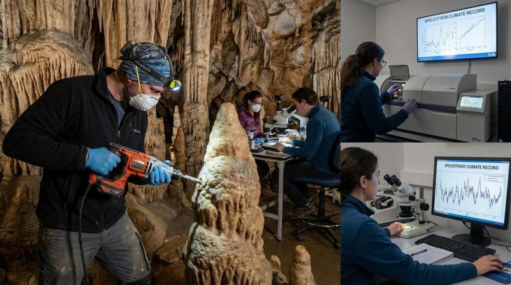
When stalactites and stalagmites merge, they create columns—natural pillars recording centuries of vertical growth. Draperies, by contrast, form when water runs along an inclined wall. These folded sheets display “bacon-strip” banding caused by iron and manganese impurities. Each stripe marks subtle shifts in water chemistry over time—nature’s own climate archive (USGS.gov).
For explorers practicing cave terrain analysis, these formations aren’t just beautiful—they’re data. They reveal airflow, ceiling height, and hydrology patterns competitors rarely discuss in depth. In caves, stone doesn’t just decorate. It testifies.
Exotic Geology: Flowstones, Helictites, and Other Curiosities
Flowstone and Rimstone Dams
Flowstone looks like a frozen waterfall—sheets of calcite (a mineral form of calcium carbonate) deposited as water flows over walls and floors. Rimstone dams form when that mineral-rich water pools and leaves raised lips of stone, creating terrace-like basins. Early on, I misread thick bands as single flood events. In reality, layers record cycles: thicker, darker bands often signal heavier flow, while thin, pale layers suggest drier periods (think tree rings, but underground). That mistake taught me patience and better lighting during cave terrain analysis.
Helictites: The Gravity-Defiers
Helictites twist sideways and upward, seemingly ignoring gravity. I once assumed they were broken stalactites—wrong. They grow from capillary forces (water creeping through tiny ცენტრ< u>microscopic channels) and hydrostatic pressure, not dripping water. Their odd angles reveal slow seepage, not steady drops. Lesson learned: fragile formations demand distance and humility.
Cave Pearls (Oolites)
Cave pearls are polished calcite spheres formed in shallow pools. Dripping water agitates them, rolling grains so layers build evenly—like nature’s gumball machine. I once stepped too close and disrupted a pool’s surface tension, halting growth. Subtle movement matters. In caves, even small missteps echo for decades.
Scallops are small, asymmetrical scoops carved into cave walls and ceilings by flowing water. Geologists call them a natural speedometer because their size and orientation record current behavior. The steep side of a scallop faces upstream; the tapered end points downstream. Smaller scallops generally indicate faster flow, while larger ones suggest slower water (think of wind ripples on sand). By measuring diameter and mapping direction, explorers reconstruct flood intensity with surprising precision.
Boxwork forms when mineral-rich water deposits thin blades of calcite along fractures in limestone. After the surrounding rock dissolves, a honeycomb lattice remains. Spotting boxwork tells you where structural weaknesses once guided water movement. Fossils embedded in cave walls—shell fragments, crinoid stems, or coral patterns—reveal that the limestone began as an ancient seabed, later lifted and drained.
Sediment layers on the floor act as a timeline:
- Coarse gravel marks high-energy floods.
- Fine silt signals calmer pooling.
- Mud bands can trap organic debris for dating.
Careful cave terrain analysis connects these features to surface storms and climate shifts, turning stone into a readable archive. Each clue offers practical insight for safer navigation and smarter route planning underground. Patterns reduce guesswork and reveal hidden hazards for explorers.
Your Next Steps as a Cave Analyst
You set out to understand caves as more than beautiful underground chambers—and now you have the framework to do exactly that. You can see how formations, passage shapes, and subtle wall markings work together to tell a story written over thousands of years.
The real power of cave terrain analysis lies in observation. A stalactite’s alignment, a scallop’s curve, the slope of a tunnel—each detail reveals movement, pressure, and time. Miss those connections, and you miss the cave’s true history.
On your next trek, don’t just explore—analyze. Start with one feature and ask what formed it and why. Want to sharpen your skills and read caves with confidence? Dive deeper with our expert guides and start exploring smarter today.
 Janice Martinezelous has opinions about cave navigation and terrain analysis. Informed ones, backed by real experience — but opinions nonetheless, and they doesn't try to disguise them as neutral observation. They thinks a lot of what gets written about Cave Navigation and Terrain Analysis, Cave Trekking Basics and Survival Skills, Horizon Headlines is either too cautious to be useful or too confident to be credible, and they's work tends to sit deliberately in the space between those two failure modes.
Reading Janice's pieces, you get the sense of someone who has thought about this stuff seriously and arrived at actual conclusions — not just collected a range of perspectives and declined to pick one. That can be uncomfortable when they lands on something you disagree with. It's also why the writing is worth engaging with. Janice isn't interested in telling people what they want to hear. They is interested in telling them what they actually thinks, with enough reasoning behind it that you can push back if you want to. That kind of intellectual honesty is rarer than it should be.
What Janice is best at is the moment when a familiar topic reveals something unexpected — when the conventional wisdom turns out to be slightly off, or when a small shift in framing changes everything. They finds those moments consistently, which is why they's work tends to generate real discussion rather than just passive agreement.
Janice Martinezelous has opinions about cave navigation and terrain analysis. Informed ones, backed by real experience — but opinions nonetheless, and they doesn't try to disguise them as neutral observation. They thinks a lot of what gets written about Cave Navigation and Terrain Analysis, Cave Trekking Basics and Survival Skills, Horizon Headlines is either too cautious to be useful or too confident to be credible, and they's work tends to sit deliberately in the space between those two failure modes.
Reading Janice's pieces, you get the sense of someone who has thought about this stuff seriously and arrived at actual conclusions — not just collected a range of perspectives and declined to pick one. That can be uncomfortable when they lands on something you disagree with. It's also why the writing is worth engaging with. Janice isn't interested in telling people what they want to hear. They is interested in telling them what they actually thinks, with enough reasoning behind it that you can push back if you want to. That kind of intellectual honesty is rarer than it should be.
What Janice is best at is the moment when a familiar topic reveals something unexpected — when the conventional wisdom turns out to be slightly off, or when a small shift in framing changes everything. They finds those moments consistently, which is why they's work tends to generate real discussion rather than just passive agreement.